

UPDATE: Tornado warnings for Goshen County have expired. The southeast Wyoming area remains under a hazardous weather advisory for possible thunderstorms this evening. A tornado watch remains in effect for areas of northeastern Wyoming, western Nebraska and southwestern South Dakota through 9 p.m. MDT Monday.
UPDATE: As of 6:41 p.m. Monday, all tornado warnings have expired for Goshen County and most of the rest of eastern Wyoming. Tornado warnings remain in effect in the Scottsbluff and Harrisburg areas in western Nebraska. Goshen county and the rest of eastern Wyoming remain under a Tornado Watch until 8 p.m. Monday evening.
UPDATE: Tornadoes reported northeast of Pine Bluffs, northeast at 25 mph; baseball sized hail likely. Tornado warning remains in effect until 5:45 p.m. for portions of Goshen County.
UPDATE: City and county offices are closing in Torrington
UPDATE: The National Weather Service in Cheyenne has issued a TORNADO WARNING for portions of western Goshen County until 4 p.m. Reports of a tornado south of Ft. Laramie heading northbound.
UPDATE: All Torrington Little League baseball games this evening have been canceled.
UPDATE: The National Weather Service has issued a Tornado Watch until 8 p.m. for several counties in eastern Wyoming, western Nebraska and northern Colorado, including Goshen County.
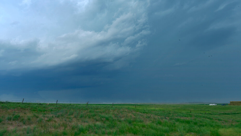
A tornado watch means conditions are favorable for the development of tornadoes in and near a watch area. During a watch, people should review tornado safety rules and be prepared to move to a place of safety if threatening weather approaches.
UPDATE: The National Weather Service in Cheyenne indicated Monday morning a predicted storm can be expected to move through the Goshen County area late Monday afternoon into early evening.
During a conference call Monday, National Weather Service forecaster Chad Hahn said this storm and its indicators were rare in eastern Wyoming. Early predictions indicate a probability of three distinct storms moving through the area, with a high probability of at least one cell crossing into southern Goshen County and moving to the northeast.
Heavy rain, large hail, flooding and high winds, with a possibility of tornado activity, is associated with these storms.
Hahn urged people to stay aware of developing weather conditions. One source is the National Weather Service website for the Cheyenne Forecast Center, www.weather.gov/cys/. The average time of advance warning for severe weather is about 12 minutes nationwide.
“It’s impossible to say how much lead time we can give folks,” Hahn said. “We strive to make it as long as possible. People need to have multiple ways to receive warning information, should one be issued.”
CHEYENNE – The National Weather Service has issued a Hazardous Weather Outlook alert for portions of southeast Wyoming and the western Nebraska Panhandle.
A low-pressure area crossing the northern Rockies is expected to spawn severe thunderstorms along the Laramie Range, bring the possibility of large hail, flash flooding and damaging winds. Thunderstorms are expected to develop by around 2 p.m., quickly becoming severe as they move in an easterly direction.
Conditions will also be favorable for the potential formation of tornadoes, one or two of which could be strong and remain on the ground for a long duration. The greatest risk is anticipated along and east of the Laramie Range, particularly along a line from Douglas to Chugwater and points north and east.
The National Weather Service reminds residents to be mindful of flooding and to not drive or walk across flooded roads. Residents are also advised to take measures to protect outdoor animals and plants from the potential for large hail with this weather system.
Safety tips are available at www.weather.gov/safety.
Showers and thunderstorms are likely, mainly after 3 p.m. Monday will be partly sunny otherwise, with a high in the low 80s and breezy with an east-southeast wind from 10 to 15 miles per hour, increasing to 20-25 mph in the afternoon. Chance of precipitation is 60 percent.
Showers and thunderstorms are likely before midnight Monday. Some storms could be severe with large hail, damaging winds and heavy rain. Chance of precipitation is 70 percent with a low temperature reaching the upper 40s.
Tuesday is expected to be mostly sunny with a high in the mid 70s and breezy with southwest winds from 5 to 15 mph, increasing to 15-25 mph in the afternoon. Winds could gust into the 35 mph range.


