

National Weather Service in Cheyenne has issued a Hazardous Weather Outlook statements for eastern Wyoming and western Nebraska for Monday night.
This item is available in full to subscribers.
To continue reading, you will need to either log in to your subscriber account, below, or purchase a new subscription.
Please log in to continue |
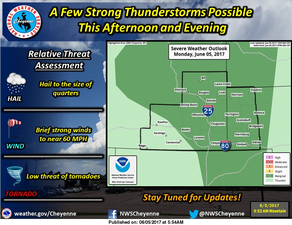
CHEYENNE – The National Weather Service in Cheyenne has issued a Hazardous Weather Outlook statement for portions of eastern Wyoming and western Nebraska through mid-week.
Scatters showers and thunderstorms are expected Monday evening. Some storms could become strong, producing gusty winds with brief gusts near 60 miles per hour and a chance for up to quarter-sized hail.
Afternoon and evening thunderstorms are expected to continue through Tuesday and into Wednesday with an additional possibility of isolated storms Thursday.
Storm chances are 50 percent Monday afternoon, decreasing to 20 percent Monday night. Lows Monday evening are anticipated in the mid-50s.
Cooler temperatures in the mid- to upper-70s are expected Tuesday behind the storm front. Tuesday will dawn partly sunny with a 20 percent chance of thunderstorms moving into the afternoon. Low Tuesday night is expected in the low 50s.


