

CHEYENNE – Confidence remains high at the National Weather Service forecast office in Cheyenne in the winter storm forecast for southeast Wyoming and western Nebraska today through Friday.
This item is available in full to subscribers.
To continue reading, you will need to either log in to your subscriber account, or purchase a new subscription.
If you are a current print subscriber, you can set up a free website account and connect your subscription to it by clicking here.
If you are a digital subscriber with an active, online-only subscription then you already have an account here. Just reset your password if you've not yet logged in to your account on this new site.
Otherwise, click here to view your options for subscribing.
Please log in to continue |
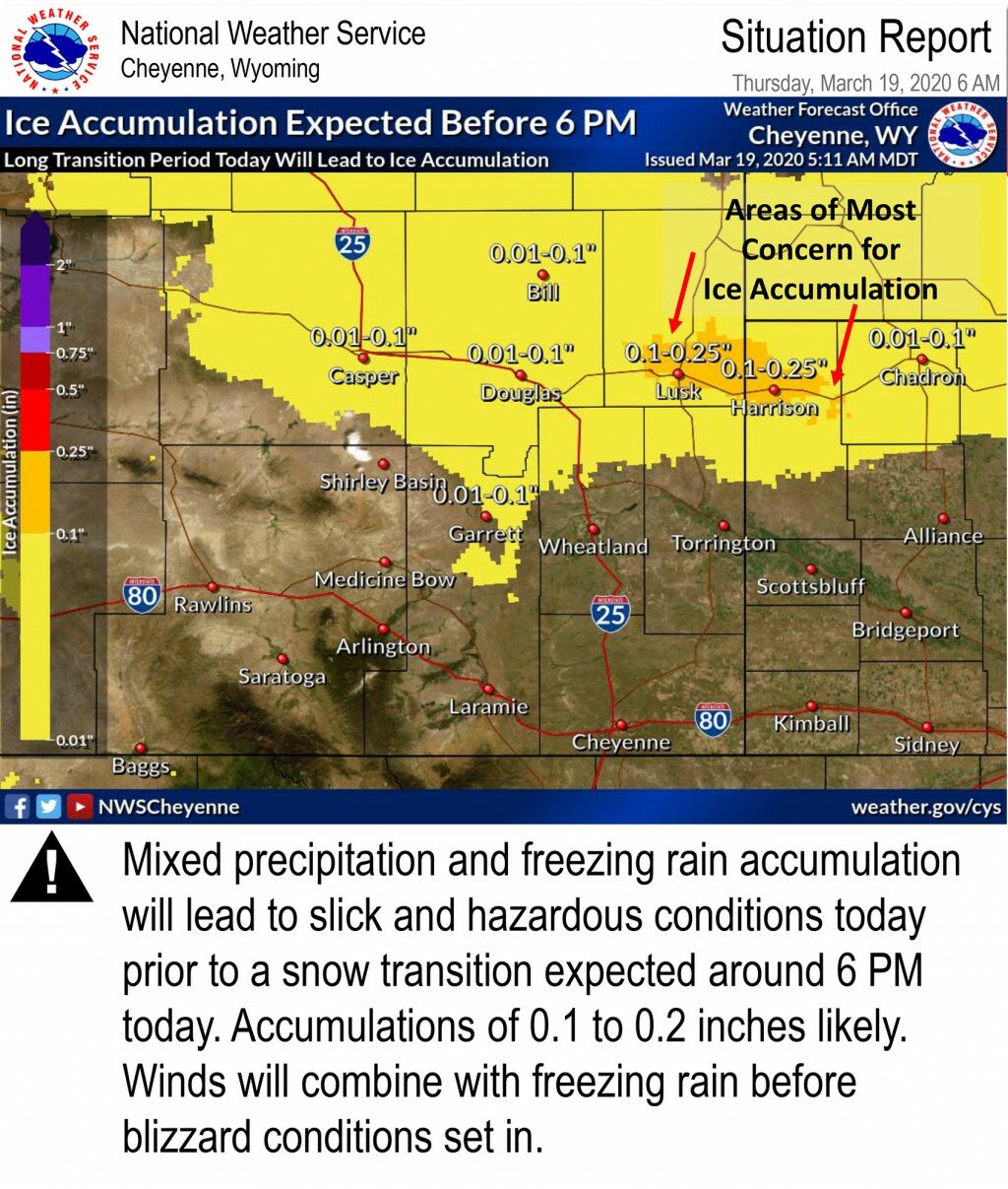
CHEYENNE – Confidence remains high at the National Weather Service forecast office in Cheyenne in the winter storm forecast for southeast Wyoming and western Nebraska today through Friday.
The good news is, snow totals for the storm have been downgraded for much of the region, according to a release Thursday morning from the agency. Snow total forecasts range from zero to 1-inch along the U.S. Hwy. 26 corridor to the potential for 6- to 8-inches in far southern Goshen County.
Goshen, Niobrara and portions of northern and eastern Platte counties in Wyoming and most of the Nebraska Panhandle remain under a blizzard warning through 6 a.m. Friday. The forecast calls for sustained winds from the north to northeast at 25-35 miles per hour, with gusts to 50 mph possible in some areas, along and east of the Interstate 25 corridor, according to the report.
Blowing and drifting snow, combined with the possibility of the storm being preceded by rain to a mix of rain and snow, could lead to difficult travel conditions across the region. Ice accumulation of 0.01- to 0.25-inches are possible in northern Goshen and Platte counties and all of Niobrara County in advance of the snow are forecast, with a band of greater accumulation along Hwy. 20 north of Lusk and extending into Sioux County in western Nebraska.


